
Pico Rivera ZIP Code Coverage
Postal codes associated with Pico Rivera do not all carry the same role. 90660 is the principal city label and is tied to Whittier Narrows in county data. County master data also places a small part of Pico Rivera under 90601. 90661, 90662, and 90665 appear in USPS scheme or county code material as special or legacy designations that need address-level checking.
| ZIP | Areas or role | Post office | Notes |
|---|---|---|---|
| 90660 | Principal Pico Rivera delivery area; Whittier Narrows label | Pico Rivera Post Office and nearby stations | Main street-delivery ZIP |
| 90661 | Pico Rivera postal designation | Pico Rivera postal system | Verify special or limited use per address |
| 90662 | Pico Rivera postal designation in USPS scheme | Pico Rivera postal system | Verify current use per address |
| 90665 | Historically grouped with Pico Rivera in code lists | Verify through live USPS lookup | Do not treat as a neighborhood |
| 90601 | Mostly Whittier, with a county-listed Pico Rivera portion | Whittier delivery facilities | City and ZIP mismatch at the edge |
The table is a routing guide, not a ZIP-wide resident export. The Los Angeles County Registrar-Recorder service hub confirms county office routes, while USPS confirms a specific mailing address.
County services can help with the next records step, but the ZIP itself remains a delivery clue.
90660 and the Pico Rivera ZIP Code
90660 is the principal residential and business ZIP associated with Pico Rivera. County data connects the label with Whittier Narrows, the lowland geography between the Rio Hondo and San Gabriel River story. That association explains why a mailing label can reach areas that do not look like a neat municipal shape on a map.
The Pico Rivera Post Office is listed at 6320 Passons Boulevard, ZIP+4 90660-9998. The research capture recorded weekday retail hours of 9 to 5 and Saturday hours of 8:30 to 12, with phone 562-942-0168. Crossroads Plaza at 9160 Whittier Boulevard and Slauson at 9240 Slauson Avenue are nearby listed facilities, each with its own ZIP+4. Hours and services change, so USPS is the live source.
For an address in 90660, verify the exact line and ZIP+4 before using an assessor or city search. A ZIP+4 identifies a delivery segment, not a parcel, owner, or household.
Pico Rivera 90661, 90662, and 90665
90661 and 90662 appear as Pico Rivera postal designations in USPS scheme material. 90665 is historically grouped with Pico Rivera in postal or county code lists. The research does not support treating any of these as separate populated neighborhoods. They may have special, limited, PO-box, or legacy roles, and the current use must be checked for the address being studied.
Use the USPS tools “Find by City and State” and “Find Cities by ZIP” to see recognized place names. Then run “Find by Address” for the actual street line. If an old document uses one of these codes, preserve it as printed and add the current USPS result beside it. Do not rewrite a historic postal code into a modern city claim without evidence.
A ZIP directory that lists a code without its role can mislead. The safest result is a verified address, a postal place, and a separate municipal jurisdiction check.
90601 at Pico Rivera’s Edge
90601 is mostly associated with Whittier, yet the county master table includes a portion of the City of Pico Rivera. This is the clearest local example of a ZIP code and city limit asking different questions. A mailing address can use a Whittier delivery place while a parcel lies within Pico Rivera, or a city label can appear beside a ZIP that serves more than one jurisdiction.
Confirm city limits with municipal or county maps and parcel jurisdiction. Confirm the ZIP with USPS. Confirm land identity with the Assessor Portal. Each system has a different custodian and a different purpose. A residents directory should retain those distinctions instead of using the ZIP as a shortcut for a place boundary.
Boundary check. “Pico Rivera mailing address” and “inside Pico Rivera city limits” are separate claims. Verify both before connecting a record to the city.
USPS Fields for Pico Rivera ZIP
The USPS lookup is the most direct address-to-ZIP tool in the research. It accepts a street address with city and state, or a city and state, or a ZIP to find recognized city names. The result can standardize the address and provide ZIP+4. It does not provide residents, owners, deeds, or a parcel map.
| USPS mode or field | Type | Required | Result |
|---|---|---|---|
| Find by Address: street address | Text | Yes | Standard address and ZIP+4 |
| City | Text | Yes | Mailing city match |
| State | Dropdown | Yes | California selection |
| Find by City and State | Text and state | Yes | ZIPs assigned to a place name |
| Find Cities by ZIP | ZIP text | Yes | Recognized postal place names |
| Find | Button | Yes | Submits the lookup |
The USPS ZIP Code Lookup is the address verification route. Use the returned string as the search key for the assessor and city archive, then save the parcel and legal description from the next source.
Pico Rivera Postal Facilities
Postal facilities help explain why a ZIP label can span a broad area. The Passons Boulevard office is the main named facility in the research, with Crossroads Plaza and Slauson listed nearby. A post office location is not a city boundary and does not hold a public resident directory. It only shows how mail service is organized.
The county branch-office page is a different kind of location list. It helps identify where county services may be delivered, while USPS controls retail and delivery information. Never substitute one office directory for the other.
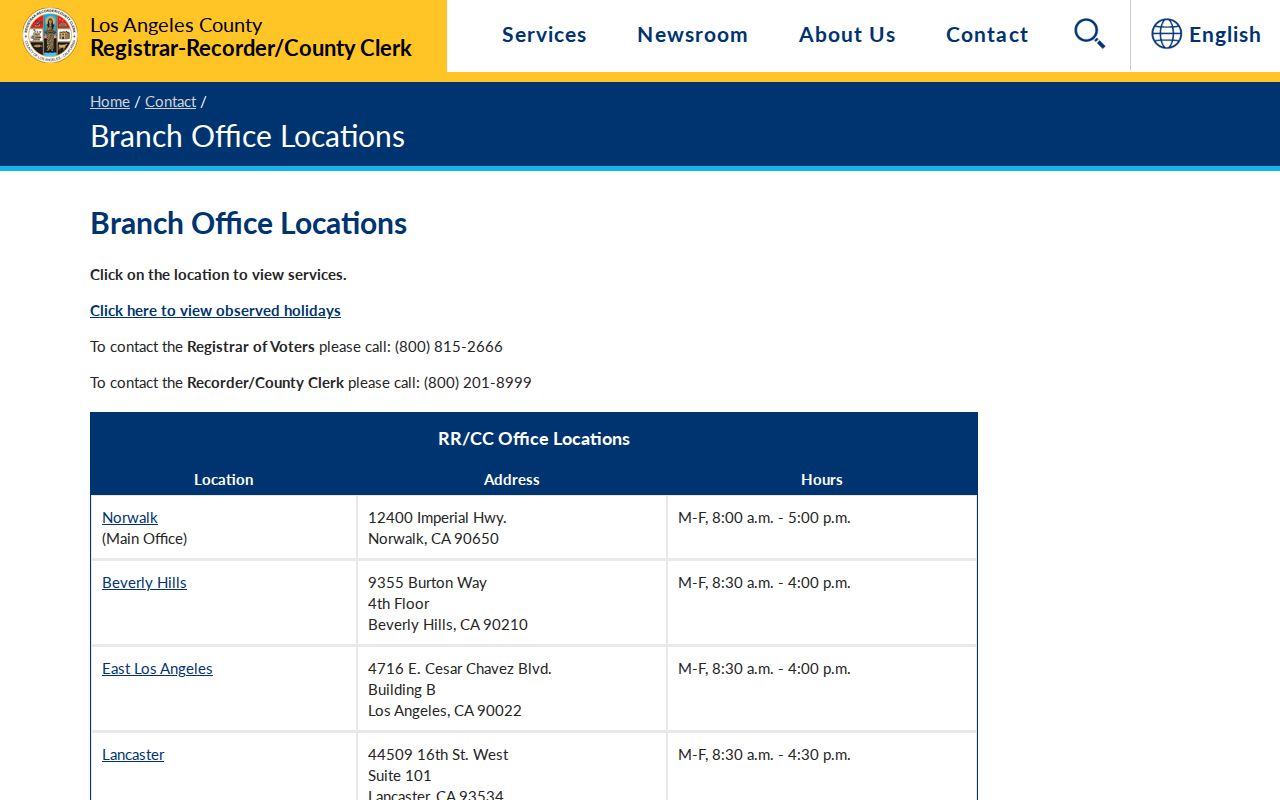
Branch locations support a records visit, but an address still needs the proper ZIP and custodian route.
The county clerk and Recorder provide separate filing services for marriage, fictitious business names, deeds, and vital records.
County office geography can guide a request, while postal geography only confirms delivery.
Pico Rivera Assessor Search After ZIP
No local portal in the research offers a useful ZIP-wide resident export. The Assessor Portal searches a specific address or AIN. GIS can show mapped areas, but ZIP layers depend on the service. The voter status tool is identity-gated, and voter files are not open ZIP browsing. A sound ZIP guide therefore uses the postal code to narrow an address list, not to claim a full roster.
- Verify the street line, city, state, ZIP, and ZIP+4 with USPS.
- Run the address through the Los Angeles County Assessor Portal and save the AIN and situs.
- Use the assessor map or a suitable county or city GIS layer to compare parcels and jurisdiction.
- Move to the Recorder by owner name and year if a deed or land chain is needed.
- Use the Pico Rivera records library for a permit or city report tied to the address.
Once the ZIP narrows the search to a street, the Pico Rivera street directory handles the address chain. It does not turn every parcel result into an occupant claim.
Pico Rivera’s Whittier Narrows ZIP
Whittier Narrows and the two river corridors are part of the local postal story. Pico and Rivera grew in an agricultural landscape between the Rio Hondo and San Gabriel River. Rail lines, orchards, roads, floodplain geography, and later tract building shaped how addresses were named and served. A ZIP label captures delivery geography, not all of that history.
County data’s connection between 90660 and Whittier Narrows is useful context when an old address or directory entry looks wider than the city. Compare the postal label with a tract map, legal description, and municipal map. The record trail is stronger when a land identity survives the change in delivery name.
Pico Rivera Address Forms for ZIP Searches
Three address forms often appear in a Pico Rivera postal directory. Situs is the physical parcel used by assessment and permits. Mailing is the delivery point for a tax notice or correspondent and may be elsewhere. Legal description is the tract, lot, or metes-and-bounds identity that controls land records. ZIP belongs to the mailing layer, not the legal identity.
- ZIP+4
- A postal extension that narrows delivery beyond the five-digit ZIP.
- PO-box ZIP
- A code or role serving postal boxes or limited delivery, which needs address-level confirmation.
- Carrier route
- A delivery grouping used by postal operations, not a city parcel boundary.
- AIN
- The assessor’s parcel key, separate from a ZIP or street name.
Keep all three forms in research notes. A current mailing address can change while a legal lot remains, and a ZIP can serve more than one jurisdiction. This is why the ZIP guide should hand off to the parcel and street record systems for resident or ownership questions.
Pico Rivera ZIP Codes and City Limits
ZIP codes are operational delivery areas. City limits are municipal jurisdiction. Assessor parcels and legal descriptions are land records. Census ZCTAs are approximate statistical areas, not USPS boundaries. These lines can overlap without matching.
For a Pico Rivera address, use USPS for delivery, county or municipal maps for limits, the Assessor Portal for the parcel, and the custodian for the record. A ZIP guide can make an address search faster, but it cannot supply a complete resident roll. Records may also be protected under Safe at Home, voter rules, vital statutes, court rules, or other law.
Lawful use. ZIP, parcel, and address data support personal, lawful research. Do not use a ZIP code, name, or map to stalk, threaten, intimidate, or harass anyone.